

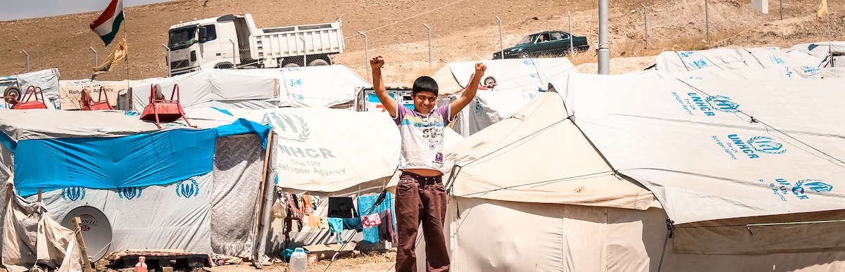
Formal humanitarian entities are no longer the only groups responding to moments of crisis that follow natural disasters or political turmoil. The internet has also opened up a space for the general population to volunteer their time to sift, sort and map data that could be helpful in improving the speed and efficiency of response.
By collecting data from geo-tagged digital photos, aid requests posted on Twitter, aerial imagery, Facebook posts, SMS messages and other digital sources, volunteers around the world are mobilising to create maps and other data sets that offer unprecedented depictions of communities needs within a crisis.
It was the 2010 Haiti earthquake that brought the process of crowdsourced crisis mapping to the attention of the world, with projects such as Ushahidi working to map needs and responses across the country. Since then the number of volunteers and amounts of data collected has continued to grow with each crisis. 230,000 tweets were posted within two days of Typhoon Haiyan hitting the Philippines in 2013, and it was through the quick sifting of data that volunteers were able to highlight and map key areas of destruction, potentially saving many more lives.
Barriers to using crowd-sourced maps
However, while these crowdsourced maps and datasets are seen by many as useful, providing fresher and more accurate information, new research by Amelia Hunt and myself has shown that they are under-utilised, or even ignored by aid organisations and rescue operations. We wanted to find out why, and undertook to examine 51 deployments of crowdsourced maps to find better ways of working with volunteers before a crisis even hits.
One major issue is that the humanitarian sector now faces a data deluge. Being more used to having to scrap around for data in times of need, this sudden influx is causing headaches. Of course, more data does give the potential for more targeted response plans, but without adequate filtering and processing the new data becomes an extra burden. Our research found that in acute emergencies, a lack of time to assess data leads to new and untested data sources – such as crowdsourced maps – being dismissed.
That isn’t the only issue faced though, concerns have been raised over the capabilities and legal standing of volunteers working remotely to collect and map data. And deep-set notions of what is good data also affects expectations surrounding the data organisations were willing to accept – this is often based on past experiences or data presented by what are seen as ‘reliable’ humanitarian ‘brands’.

People helping on the streets after the 2017 Mexico City earthquake
Solutions
However, despite these concerns there is a great potential for improving humanitarian systems through crowdsourced data and maps. And so ways of making this work better must be sought.
Our research suggests a three-pronged strategy for better helping humanitarian organisations, NGOs and volunteer remote map makers to work together. These are Regionalise, Prepare and Research.
The three work together to first use a research-informed approach to highlight areas of risk. Once these areas are established then a process of preparedness is required. Here data collection begins before a crisis takes hold. Data is presented to humanitarian organisations while they have time to examine and cross check the information. This builds trust between volunteer communities and the formal sector as well as giving a base level of information. This is the kind of work that is already being carried out by projects such as Missing Maps and Humanitarian OpenStreetMap. Regonalising then builds local networks of data collectors and validators ahead of a crisis. Upskilling local communities with digital skills or establishing local digital humanitarian hubs which could act as sub-sets of organisations such as the Digital Humanitarian Network.
However, preparedness work is difficult. Even when the right area is selected, resources – both financial and voluntary – are always more drawn towards moments of crisis, and the lack of international media focusing on at-risk communities diminishes the sense of urgency to support preparedness efforts.
Yet, The Federal Emergency Management Agency in the USA has noted that for every $1 spent on disaster preparedness, $4 is saved in the disaster itself. Meaning that early crowd-sourced mapping efforts, which pre-map access routes and medical facilities, for example, could save money, as well as lives.
The internet has given communities a new platform to voice their needs in times of crisis. And more people and volunteer organisations than ever are hearing this, and are collecting and sorting this data. But without preplanning, this extra data becomes lost or unused in moments of acute crisis. Instead, perhaps we need to reimagine crisis maps as ‘pre-crisis maps’ or perhaps ‘dormant crisis maps’, preparing them early allowing for them to be more readily integrated into the humanitarian response as legitimate and valid interventions.
Photo by Jonathan Ramalho on Unsplash
.


